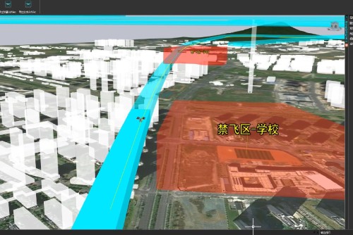
Core function: To meet the requirements of airspace planning and management, as well as route design for flight service centers and test bases, to achieve terrain scene construction, airspace planning for test flight areas, restricted areas, and no-fly zones, takeoff and landing site layout design, route horizontal and vertical design, and other functions.
Main function: To assist airspace planners in determining appropriate flight paths, flight altitudes, and airspace separation to ensure safe distances between low-altitude aircraft and avoid conflicts.
Key technology: independently developed based on open-source engines; can quickly generate 3D terrain models; Using the wire method and pattern method of route design to automatically plan the line position and quickly generate the route centerline that meets the conditions.
Application scenarios and value: Meet the airspace planning and route design of Class A and Class B flight service stations, flight service centers, and test flight bases.